7″ touchscreen flight tracker · coming soon
See the flight. Not just the flight number.
WingsAbove turns the sky above you into a live 7-inch touchscreen: the aircraft on a real map, the plane in its actual airline livery, and one tap into its route, details and live flight. No phone to open. It is already there.
Be first to back it on launch day. No deposit. One launch heads-up.
Planned retail $299Launch pricing planned from $249

The 7″ panel · live over Wi-Fi
Built around the aircraft, not a row of data.
Flight numbers are useful. They are not the reason most of us look up. WingsAbove starts with the aircraft itself, then lets you go deeper when something catches your eye.

From “what is that?” to the whole flight in a few taps.
The product makes more sense when you see the screens in the order you actually use them.
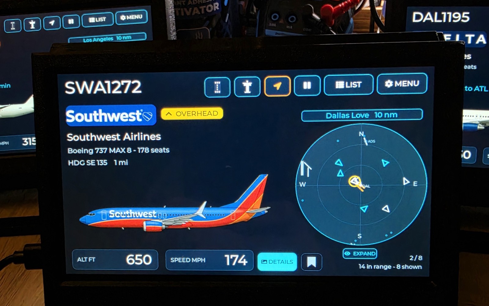
Everything overhead, in real paint
The card cycles through every aircraft in range — real airline livery, live radar, route, altitude and speed.
⇆ Swipe L / R to change flights · ❚❚ tap to hold one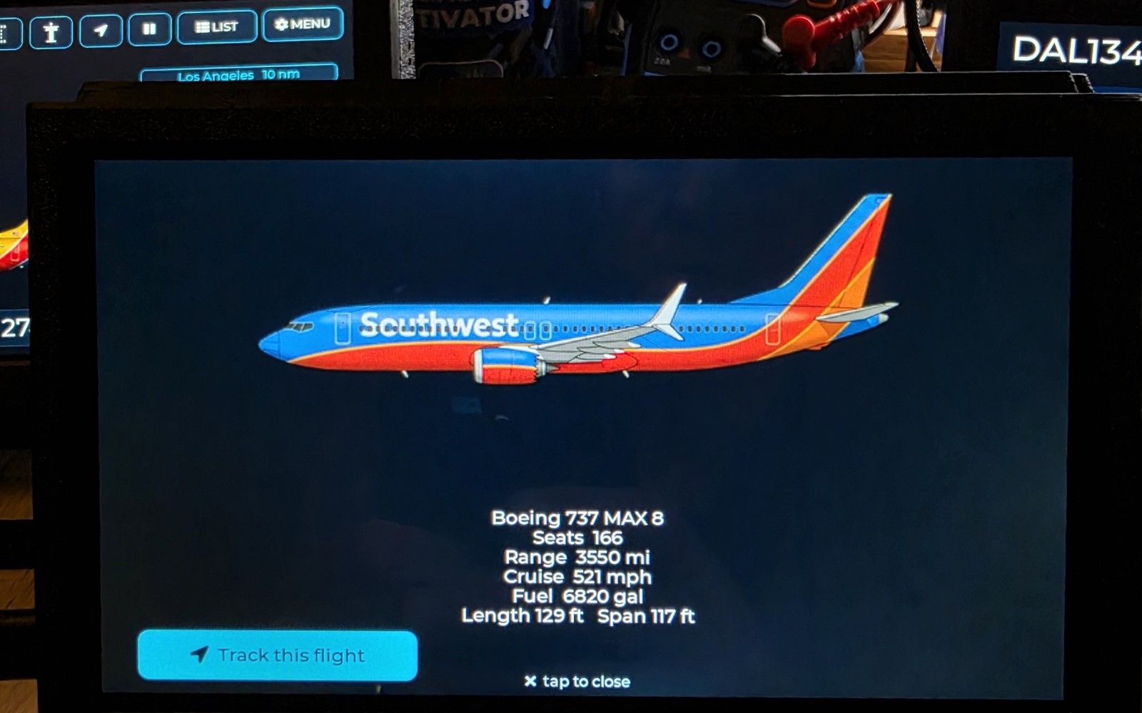
Tap into the aircraft itself
Seats, range, cruise, fuel and dimensions — then jump straight from the aircraft card into live flight tracking.
☰ Tap DETAILS · tap Track this flight
Follow it gate to gate
Live flight path, terminal, and on-time or late — it stays with the plane the whole way.
➤ Tap Track this flight · tap the map to zoom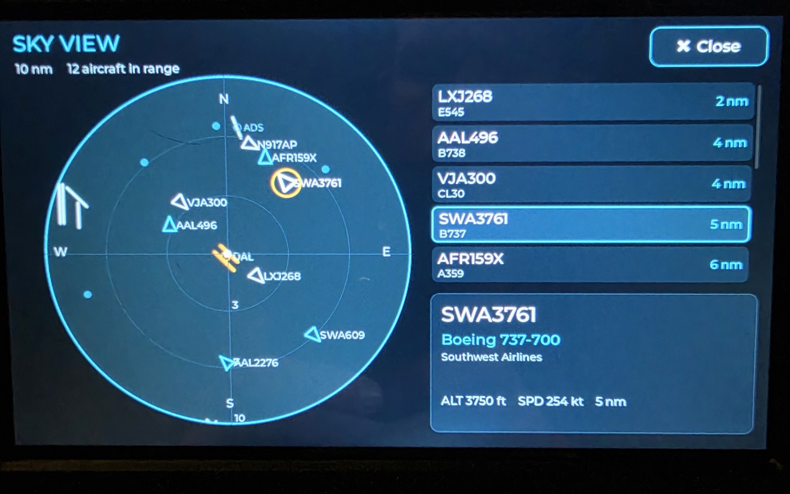
Every aircraft in range, one radar
The whole sky at a glance, with a live list sorted by distance.
⤢ Tap EXPAND · tap any blip or row to jump to it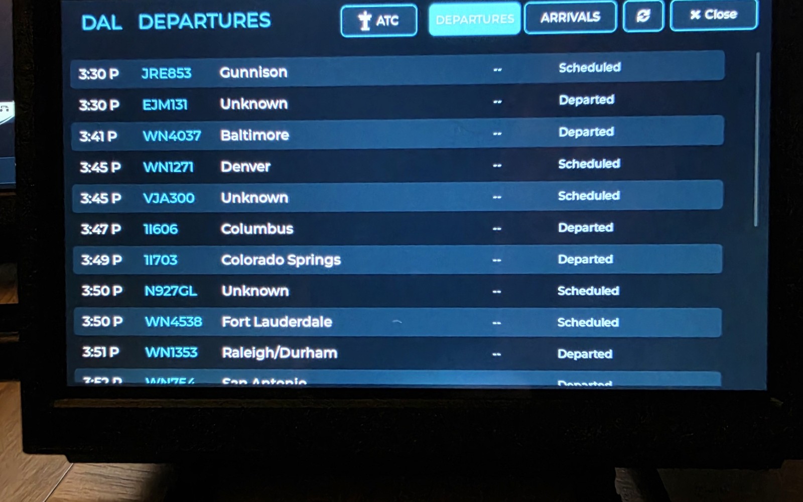
Live departures & arrivals — anywhere
Pull up any airport's board, and scan a code to listen to its tower live.
↕ Swipe to scroll · tap ARRIVALS / DEPARTURES / ATC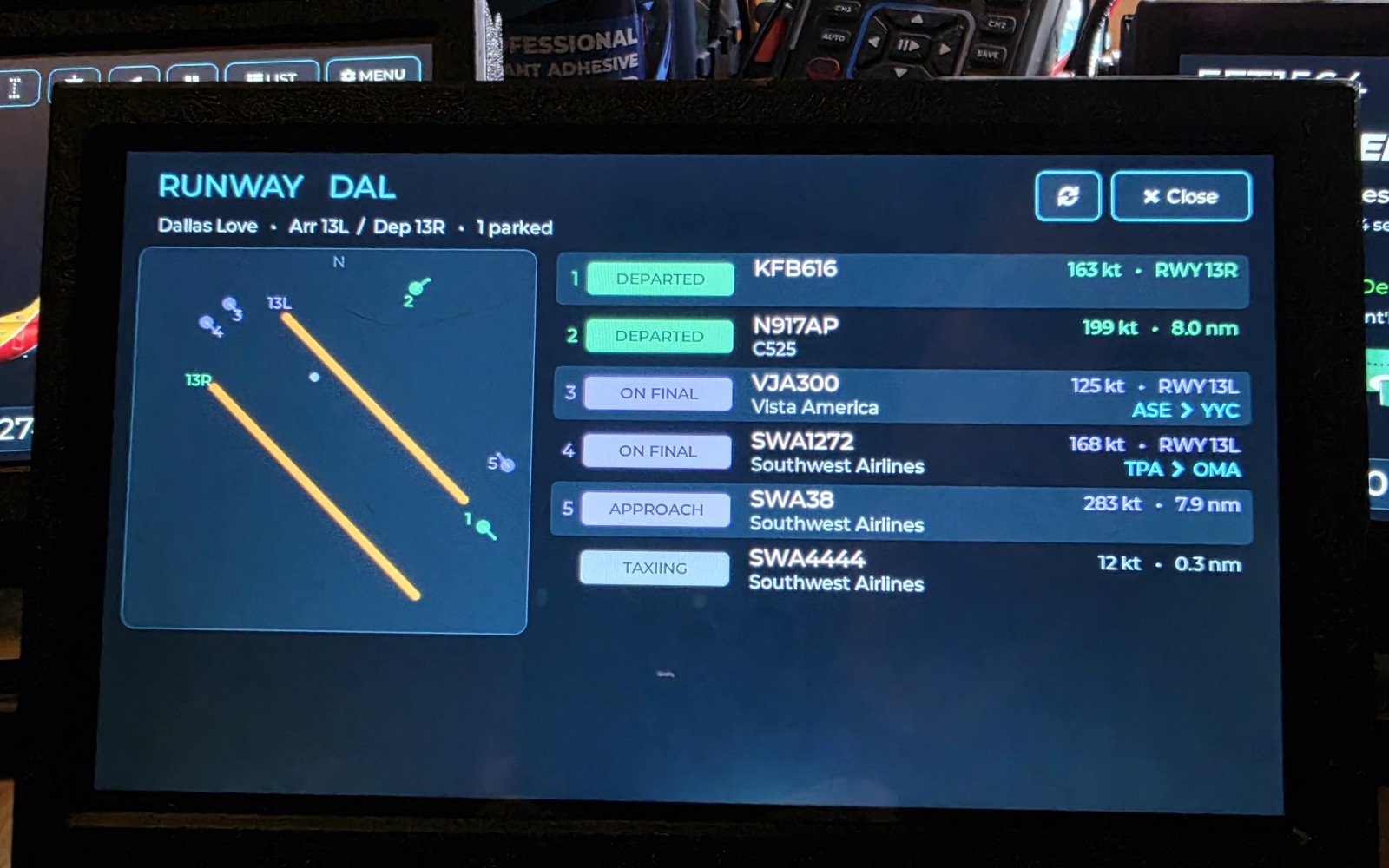
Watch the airport move
See the runway layout and the aircraft using it — departed, on final, approaching and taxiing — updating as the field changes.
✈ Open RUNWAY · watch arrivals and departures update liveSee it running on real hardware.
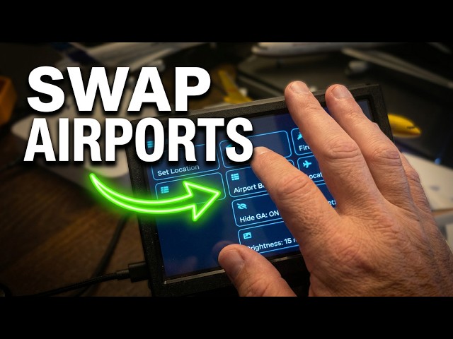
No concept render required — watch the touchscreen, Crew Mode and live views move.

Built to stay interesting after the first week.
Plug it in, connect to Wi-Fi, set your location, and let the sky keep changing the screen.
Live radar, real map
A home-centered radar over actual coastlines, borders and runway layouts. Planes sweep across exactly where they’re flying overhead — right now.
A card for every plane
Airline logo and livery, aircraft type, origin → destination, altitude and speed — pulled live and cached so it’s instant.
Follow any flight
Tap a plane for a full route map with a live moving dot. Or search a flight number and track it anywhere on Earth.
Your airport's board
A live departures & arrivals board for the airport nearest you — every flight, time and gate. Tap a row to follow it out.
Listen to the tower
Scan the on-screen code and hear live ATC for your airport on your phone, right while you watch the traffic overhead.
Follow it to the gate WingsAbove+
Optional WingsAbove+ adds the metered information that costs us to deliver: live status, gate, terminal, ETA and alerts. The core overhead experience stays with the device.
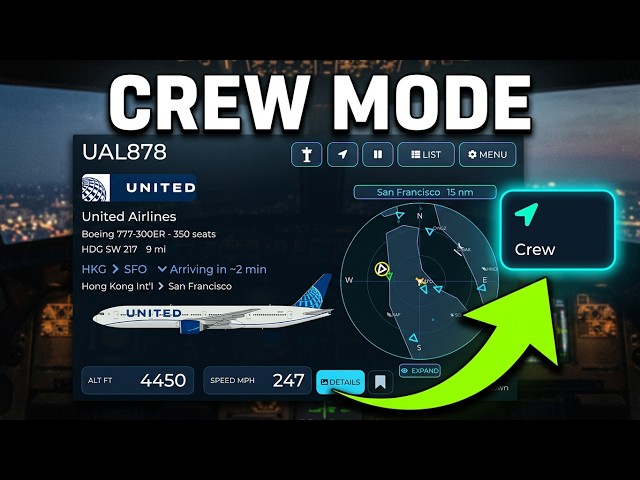
Crew Mode — follow the flights that are yours
Load a pilot’s current schedule and WingsAbove follows that line of flying — what is airborne, what is next, what just landed, and how long until home. If the roster changes, upload the revised schedule and replace the old one. Or point it at the tail numbers that matter to you.
Read what the crews are actually saying
ACARS is the text system airline crews use in flight — dispatch, maintenance, catering, and the occasional moment of honesty at 30,000 feet. When your sky goes quiet, WingsAbove fills it with real messages instead of an empty screen.
Tap one to open the full list. Where we can identify the flight, one more tap starts tracking it. Messages are curated and anonymised by acarsdrama.com, whose Jumpseat feed we licence — the words are theirs, and the crews stay anonymous.

When something special flies over, the whole screen becomes the show.
A military jet, an air ambulance, a police helicopter, a rare wide-body — WingsAbove flips into a full-screen, keynote-style hero shot with the photo, the story, and the callsign. The moments you’d have missed, framed.
Your sky deserves a screen of its own.
Planned retail is $299. Join the waitlist for launch pricing planned from $249 and first access when the 7-inch model opens.